Today Only! Save $10! Get Rose’s Then and Now Bible Map Book for ONLY $19.99 (Reg. $29.99).
Hurry! Offer good while supplies last.
Tired of looking at the tiny maps included in the back of your Bible and still not seeing the information you need? Most study Bibles provide maps showing only the position of cities during Bible times in super small print, making it hard for you (and your students) to clearly see where Bible places are located today.
Enjoy having easy-to-read, full-color maps at your fingertips with Rose’s Deluxe Then and Now® Bible Map Book. It features larger print, easy-to-read type and clear plastic overlays showing the location of modern cities and countries in red. Now you can easily see where Bible places are located today!
- Enjoy having over 25 full-color Bible maps and 8 clear plastic overlays showing the modern-day locations of key Bible places—including the Holy Land, the Middle East, Paul’s missionary journeys, etc.
- Plus! Get its CD-ROM FREE. Includes JPG and PDF files of ALL the maps—making it easy to search/enlarge the maps, print out handouts, and put full-color maps into PowerPoint® presentations.

Rating: 
For Today Only! SAVE $10! Get the Rose’s Deluxe “Then and Now” Bible Map Book for JUST $19.99 (Reg. 29.99). Hurry! You have less than 12 hours left! (Offer good while supplies)
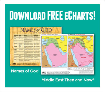
FREE Then and Now Bible Map:
Holy Land—New Testament
 Send this printable PDF to those you disciple, your friends, family, pastors, church leaders, youth group leaders, and small group members FOR FREE!
With Easter coming up, you (and your students) will soon be going through New Testament stories, which talk about Nazareth, Galilee, Bethlehem, Garden of Gethsamane, Mt. of Olives, Jerusalem, and more. Easily see where these Bible places would be located today with this incredible full-color Bible Map. This “Then and Now” Bible map also includes a clear diagram of the city of Jerusalem during the time of Jesus—showing the locations of key places mentioned in the Easter story.
This week’s printable eChart is packed with incredible visual aids, including—
- A full-color Bible Map of the Holy Land during New Testament times. It also shows the location of modern cities and countries in red. Perfect visual aid to add depth to any Easter or New Testament study.
- Clear diagram of Jerusalemduring the time of Jesus—shows the location of key places mentioned in the Easter story, such as the Upper room, Herod’s palace, and Golgotha.
This is just 1 map from Rose’s Deluxe “Then and Now” Bible Map Book, which is packed with dozens of full-color Bible maps, clear plastic overlays, charts, and timelines. Click here to find out more about Rose’s Deluxe “Then and Now” Bible Map Book.
Please Note: Our weekly eCharts are provided as a free service, but it does cost us time and money to create and send these emails. Any order from Rose-Publishing.com is appreciated!
TODAY ONLY!
Save $10 on Rose’s Bible Map Book
Rose’s Deluxe “Then and Now” Bible Map Book

Overall Rating:
Now you can easily see where Bible places are today. This Deluxe Version includes three times more Bible maps as Rose’s original Bible map book. PLUS it features a CD-ROM of all the Bible maps and modern-day boundaries so you can add Bible maps into your own teaching material— such as handouts, PowerPoint presentations, etc. Perfect for students, Bible study leaders, pastors, professors, and others who enjoy Bible study.
Enjoy having—
- Over 25 easy-to-read maps suited for basic overviews of the Bible.
- Over 8 clear plastic overlays that display today’s cities and countries in red. Making it easy to see where Bible places are located today.
- Larger, easier-to-read type than most Bible map books.
- CD-ROM of all the Bible maps and modern-day boundaries in PDF and JPG format so you can place Bible maps in your own teaching material.

Includes Dozens of Bible Maps + Clear Plastic Overlays
Old Testament Bible Maps cover areas such as —
- Middle East, Assyrian Empire, Holy Land (Old Testament), Babylonian Kingdoms, and Persian Empire.
- Abraham’s journeys, Jacob’s journey, Joseph journey, Exodus route, Jerusalem during the reign of King David and Solomon, and more.
New Testament Bible Maps include—
- The Holy Land during the time of Jesus (and a list of where Jesus walked)
- Map of Jerusalem at the Time of Jesus
- Paul’s Missionary Journeys (Roman Empire at AD 60)
- Journeys of Peter and Philip
- Expansion of Christianity in the Roman Empire
Packed with charts, diagrams, and timelines that show loads of information at a glance:
- New Testament and Old Testament Time Line — shows Bible events next to world history events
- Quick-reference charts listing Paul’s missionary journeys and an overview chart of Paul’s letters
- Incredible diagram of the Tabernacle layout (birds-eye view)
- Diagram of a tomb during Jesus’ time
- Chart on 18 major and minor prophets, location, to whom they prophesied, date, etc.
- Chart covering over 100 key events of Jesus’ life
Features Fascinating Facts, such as—
- Abraham’s home town, Ur, was in the area of Southern Iraq today.
- The ruins of Nineveh are in Northern Iraq
- Noah’s Ark probably landed in the area of eastern Turkey
- The wise men were probably from Iran or Saudi Arabia
- Daniel was taken as POW to Iraq and lived there the rest of his life
TODAY ONLY! SAVE $10 on Rose’s Deluxe Then and Now Bible Map Book— JUST $19.99. Don’t Wait! Get them while they’re still in stock.