FREE Middle East Map: Then & Now®
 Send this printable eChart to those you disciple, your friends, family, pastors, church leaders, youth group leaders, and small group members FOR FREE!
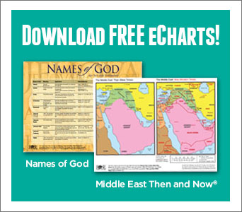
Enjoy a Free “Then and Now” Bible map of the Middle East! Download it for free today!
From Jesus’ hometown of Nazareth to the Apostle Paul’s childhood city of Tarsus, easily see where Bible places are located today with this week’s FREE Bible Map! This incredible “Then and Now” Bible map is easy to read and shows the location of modern-day countries and cities in red. With this incredible map, instantly deepen your understanding of where Jesus walked and where the disciples spread the gospel news!
This is just 1 map from Rose’s Bible Map Insert, which is packed with dozens of full-color Bible maps, clear plastic overlays, charts, and timelines. Click here to find out more about this Bible Map Insert.
Please Note: Our weekly eCharts are provided as a free service, but it does cost us time and money to create and send these emails. Any order from Rose-Publishing.com is appreciated!
Send to a Friend!
Copy and SHARE this link with your friends: https://www.hendricksonrose.com/page/wl/hr/hr-campaigns/hr-free-then-and-now-bible-maps-middle-east-echart

![]()
![]()
![]()
Then and Now Bible Maps Insert
 Overall Rating:
Most study Bibles provide maps showing only the position of cities during Bible times in super small print, making it hard for you (and your students) to clearly see where Bible places are located today.
This easy-to-read Then and Now® Bible Maps Insert features clear plastic overlays, making it easier than ever to see where Bible places are today! Imagine being able to conveniently place over 22 full-color maps within your Bible that conveniently show the location of modern-day countries and cities in red. Perfect for teachers, pastors, church leaders, Bible students, or anyone interested in learning more about the Bible.
Enjoy having these incredible features at your fingertips—
-
- 22 full-color maps, showing the Holy Land, the Middle East, Paul’s missionary journeys, and more.
- 8 clear plastic overlays showing modern day cities and countries in red
- Old and New Testament time lines —shows Bible events next to world history events
- An index showing every major place in the Bible
- Quick-reference charts and diagrams that will add depth to any Bible study! Covers key topics:
- Easy-to-follow diagram showing the families of Abraham, Isaac, and Jacob
- Chart on 12 judges and prophets, location, to whom they prophesied, date, etc.
- Incredible diagram of the Tabernacle layout (bird’s-eye view)
- Diagram of Jerusalem during Jesus’ time
- Quick-reference charts listing Paul’s missionary journeys and an overview chart of Paul’s letters
Includes Dozens of Bible Maps + Clear Plastic Overlays
Old Testament Bible Maps cover areas such as—
- Middle East, Holy Land (Old Testament), Assyrian Empire, Babylonian Kingdoms, and Persian Empire.
- Abraham’s journeys, Jacob’s journey, Joseph journey, Exodus route, Jerusalem during the reign of King David and Solomon, and more.
New Testament Bible Maps include—
- The Holy Land during the time of Jesus
- Map of Jerusalem at the Time of Jesus
- Paul’s Missionary Journeys (Shows travel routes for all 3 of his journeys)
Perfect for teachers, pastors, church leaders, Bible students, or anyone interested in learning more about the Bible. Fits inside most Bible covers making it easy to pull out and reference!

3 Reasons Why THIS Is the Best Bible Maps Insert Available
Compared to other products on the market, Rose’s Bible Maps Insert features—
-
- MORE full-color maps
- MORE clear plastic overlays
- LARGER font size (Rose’s insert features 8-10 pt. font size; average insert has 5-6 pt. font size)